
Medieval Village Layout: What Real History Teaches DMs About Small Settlements
Real medieval village layouts—nucleated, linear, dispersed—transform your D&D village map design. I tested all three in my campaign and here's what worked.
On a Sunday afternoon in March, I fell into a Wikipedia rabbit hole about English medieval villages. I'd been prepping a farming settlement for session 42 of the Shattered Coast and wanted it to feel different from the 9 other villages my players had already passed through. Three hours later, I had 14 browser tabs open, a half-eaten sandwich, and an uncomfortable realization.
Every medieval village map I'd ever drawn for D&D was the same shape.
Not literally the same — I'd varied the buildings, the NPCs, the hooks. But the layout was always identical: a clump of buildings around a central square, maybe a road cutting through the middle, done. I'd been designing settlements as if medieval villages were tiny cities, when real historical villages came in at least three distinct forms — each one shaped by geography, economy, and threat level. And each one suggests a completely different kind of dnd village map for your game.
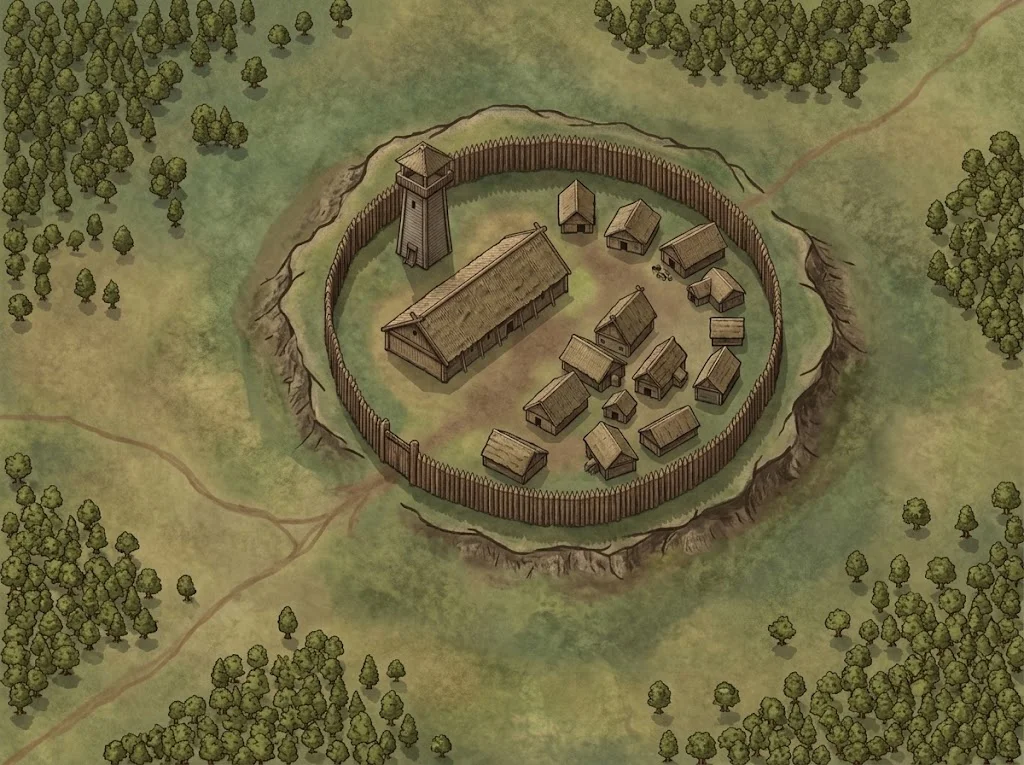
Three Medieval Village Layouts History Actually Used
Settlement scholars — yes, that's a real academic field — classify villages into three primary morphologies. The Wikipedia entry on village typology uses slightly different terminology, but these are the three forms that matter for your fantasy village map.
The Nucleated Village
Buildings gathered tightly around a central point: a village green, a well, a church. In real medieval England, nucleated villages dominated the Midlands and were tied to the open-field farming system — shared crop rotation that required everyone to live close together. Think 30-80 households packed into a quarter-mile radius.
For D&D, the nucleated layout creates social density. Every NPC knows every other NPC. Secrets don't stay secret. The tavern owner sees who visits the healer at midnight. If your village is the kind of place where gossip is currency and privacy doesn't exist, nucleated is the layout you want.
I used this for a mountain village in the Shattered Coast where the party was investigating a missing person. Because every building was visible from the village green, the players immediately grasped that hiding anything here was nearly impossible — which made the disappearance more unsettling.
The Linear Village
Linear villages developed along trade routes, river crossings, and old Roman roads. One main street, buildings lining both sides, maybe a market cross halfway down. Common across northern England and parts of Germany where a road was the village's entire reason for existing.
At the table, the linear layout changes gameplay dramatically. It creates a natural sequence — the party enters at one end and encounters the settlement in order. The blacksmith at the entrance, the tavern in the middle, the lord's manor at the far end. That sequencing is a pacing tool. You control what information the players receive and when.
The downside: sneaking is hard. Everything faces the main road. Everyone sees the party arrive. A linear settlement works against stealth — which, depending on the scenario, might be exactly what you want.
The Dispersed Settlement
Dispersed settlements — common in pastoral uplands, Wales, Cornwall, parts of Scandinavia — have no center at all. Individual farmsteads spread across a landscape, connected by paths and field boundaries. There might be a shared church or mill, but no "village square" the way most DMs imagine.
This is the layout nobody draws on a medieval village map.
And it's the one that produced the most interesting session I've run in months.
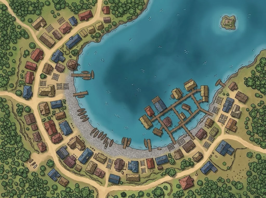 Dispersed settlements don't cluster around a square. They cluster around geography — a lake, a ridge, a river bend.
What Happened When I Actually Used Them
For session 42, I built a dispersed farming settlement in the foothills northeast of Ashenvale. No village green. No central tavern. Just 7 farmsteads spread across a valley, connected by muddy tracks, with a shared mill at the river crossing.
The party had to navigate it differently. In a nucleated village, you go to the center and talk to everyone at once. In a dispersed settlement, you visit each farmstead individually. That meant travel time within the village itself — something my players had never experienced. Jess asked, "Wait, there's no inn? Where do we sleep?" and Marcus pointed at the nearest farmstead and said, "We knock on that door."
That changed the entire tone.
Instead of walking into a tavern and getting a quest dump from an innkeeper, the party spent 40 minutes going door to door, hearing slightly different versions of the same problem from 4 different farmers. By the third farmstead, they were piecing together contradictions without me prompting them. The dispersed layout forced investigation instead of passive information gathering.
I've since used the same technique twice more. The village map generator helps — a prompt like "scattered farming hamlet, no center, individual farmsteads along a river valley" produces the kind of organic, non-symmetrical fantasy village map that a dispersed settlement needs.
Three Things the Research Changed
The historical reading shifted how I think about settlement design in specific ways.
Geography first, buildings second. Real medieval villages didn't choose their layout — the landscape chose it for them. River floodplains produce linear settlements. Defensive hilltops produce nucleated clusters. Open grazing land produces dispersal. When I started asking "what's the terrain?" before "what buildings are here?", my dnd village maps stopped feeling interchangeable. A thread on r/DMAcademy about village design made the same point: terrain should dictate form, not the other way around.
Layout implies social structure. A nucleated village has collective governance — the village green is where disputes are settled publicly. A dispersed settlement has isolated households making independent decisions. A linear village has hierarchy built into the road itself — whoever controls the entrance controls trade. These aren't worldbuilding details I need to spell out. The map communicates them silently.
Absence is information. The most powerful thing about the dispersed settlement wasn't what was there — it was what was missing. No tavern. No village green. No central authority figure. Players read that absence and drew their own conclusions about what kind of place this was. Mike Shea talks about how secrets and clues drive D&D sessions forward, and I've found that a village layout can function as a secret in itself — something the players decode through exploration rather than exposition.
What I'd Do Differently
I made mistakes applying these patterns. Some predictable, some not.
The first dispersed village was too spread out. I placed 12 farmsteads across a huge map because I was chasing historical accuracy. Players spent 20 minutes of real time walking between locations — 15 minutes too many. Real dispersed settlements are spread out by agricultural standards, not by D&D exploration standards. I've since capped dispersed village maps at 6-8 locations maximum.
I tried to retrofit layout onto existing settlements. After my Wikipedia binge, I retroactively decided that Saltwick — the fishing hamlet my players already knew with its fishmonger's shack, lighthouse, and rowboat — was "really" a linear settlement along the coast. It wasn't. Saltwick was already established in the campaign. Trying to force a historical layout onto a place the party had already explored was pointless.
I over-explained the framework to players. In one session I actually said the words "this is a nucleated settlement pattern." Dan stared at me. Marcus stared at me. Jess was on her phone. The historical framework is a DM prep tool, not player-facing narration. Show the layout. Don't lecture about it.
When This Doesn't Apply
Not every village needs a historically informed layout.
- Throwaway villages the party passes through in 10 minutes don't need layout thinking at all. Five landmarks and a road out — the sparse village approach — is faster and sufficient.
- Underground or planar settlements follow different spatial logic entirely. Historical morphology doesn't help with a dwarven cavern village or a floating cloud settlement.
- High-magic settings where teleportation is common would produce settlement patterns that don't map to medieval history. A village where everyone teleports to market doesn't need a road.
My Current Medieval Village Map Workflow
For any settlement the party will spend more than one scene in, I now ask 3 questions before opening the village map generator:
- What's the geography? River, hilltop, crossroads, coast, forest clearing. The answer usually implies the layout.
- What's the economy? Farming (nucleated or dispersed), trade (linear), fishing (coastal linear or dispersed), mining (clustered near the resource).
- What's the threat level? Bandits or hostile neighbors push toward nucleated and walled. Isolation and independence push toward dispersed.
Then I generate. A prompt like "linear farming village along a trade road, market cross in the center, fields behind the houses" gives me a completely different medieval village map than "hilltop settlement clustered around a stone church, defensive wall, overlooking a river valley."
The city map generator handles the upgrade path when a village grows into something bigger — which happened with Driftholm, where a planned one-session stop turned into 12 sessions.
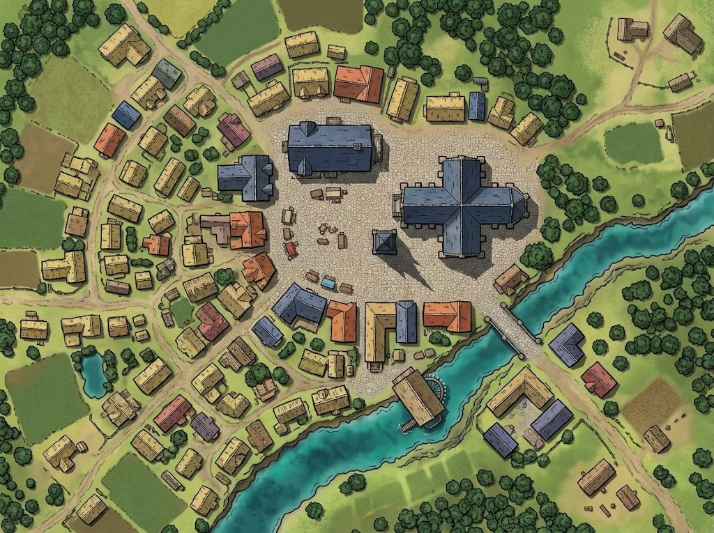 A nucleated market village — the layout most DMs draw by default. It works. But it's not the only option.
The Principle Underneath
The reason I spent 3 hours on Wikipedia and then 3 sessions testing layouts is that settlement design is worldbuilding compressed into a single image. A medieval village map isn't just a reference for where the blacksmith is — it's a statement about how people in your world live, trade, worship, and protect themselves.
You don't need to become a settlement historian. But knowing that villages come in more shapes than "clump of buildings around a square" gives you a design vocabulary that most DMs never develop.
The next time you prep a village, look at the terrain first. Let the landscape suggest the shape. And if nothing else, try one dispersed settlement — no center, no tavern, just farmsteads and footpaths.
Your players will investigate harder than they have in months.
Related Reading
- Village Map Generator — Generate medieval village maps in nucleated, linear, or dispersed layouts.
- Essential Buildings Every D&D Village Needs — What to put inside the layout once you've chosen a shape.
- Your D&D Town Map Has Too Many Buildings — When to keep a village sparse and when to add density.
- City Map Generator — For when your village grows into something bigger.

Written by
Toby
Indie Developer & Creator of FantasyGen
Toby is an independent developer focused on building AI-powered creative tools. He created FantasyGen to help game masters and worldbuilders generate fantasy maps instantly — no artistic skills required.
Continue the Campaign
How I Prep a Village Map in 10 Minutes (and Skip the Ones That Don't Matter)
I spent 90 minutes prepping a village my party left in 11. Here's my full 10-minute village map generator workflow — 6 steps, and when to skip prep entirely.
DnD Village Maps: 4 Buildings That Make a Village Feel Alive
Master the 4-building framework for any dnd village map. A tavern, a shrine, a shop, and one hidden secret generate more gameplay than 20 labeled buildings.
How to Stock a Hex Crawl With 12 Cities in Under an Hour
A step-by-step workflow for stocking a hex crawl with 12 cities using a random city generator. I prepped the entire Shattered Coast map in 45 minutes flat.