AI Continent Map Generator Online
Write a paragraph about your world's landmass — mountain ranges, river systems, coastline shapes, political borders — and get a continent-scale map with atlas-quality cartography. This continent map generator turns geographic visions into mappable reality for fantasy worldbuilding.
What is a Continent Map Generator?
A continent map generator (also called a continent map maker, landmass map creator, or continental cartography tool) creates large-scale maps of entire continents or major landmasses. Continents are the broadest canvas in fantasy cartography — they contain everything: mountain ranges, river basins, forests, deserts, coastlines, and the political borders of every nation on the landmass. Our AI continent map generator reads a geographic description and produces a detailed continental map with terrain, borders, and landmarks.
Single Continent Overworld Maps
Complete continental landmasses with diverse terrain, river systems, and varied coastlines. This continent map generator creates the primary canvas for campaign-scale worldbuilding.
Multi-Kingdom Political Continent Maps
Continental maps with nation borders, capital markers, trade routes, and contested frontiers. Generate continent map maker layouts for campaigns with geopolitical complexity.
Coastal & Peninsula Continent Maps
Continents defined by their relationship to the sea — long coastlines, deep fjords, island-fringed shores. This continent map creator produces landmasses where naval power and trade routes shape civilization.
Shattered Continent & Archipelago Maps
Fractured landmasses — a continent broken into subcontinents, island chains, and isolated fragments. Generate continent maps for post-cataclysm settings where the land itself has been torn apart.
Ice-Age & Climate-Extreme Continent Maps
Continents dominated by glaciers, tundra, deserts, or jungle — extreme climate zones that shape entire civilizations. This continent map generator creates landmasses where environment is the defining challenge.
Blank Continent Template Maps
Clean continental outlines with terrain but no labels, borders, or settlements — a blank continent map for DMs who want to fill in the political details themselves.
Continents Are Where Worlds Begin — Get the Foundation Right
A continent map is the first thing a worldbuilder creates and the last thing they perfect. Every river, mountain range, and coastline on the continent determines where civilizations rise and fall. Here's how our continent map generator handles this complexity.
Coastlines Shaped by Geology
Our continent map generator produces coastlines that reflect tectonic logic — fjords where glaciers carved, smooth shores where sediment built up, and ragged edges where plate boundaries collided. The result is a continent map that looks like a real landmass, not a random blob.
Mountain Ranges That Drive Climate
Mountains determine rainfall patterns, river origins, and temperature zones. This continent map maker places mountain ranges as the geographic backbone of the continent, creating rain shadows, river basins, and natural barriers between nations.
River Systems That Flow Correctly
Rivers flow from high ground to sea. They merge, they don't split. Lakes drain via a single outlet. This continent map creator follows hydrological rules so your world's geography doesn't break the suspension of disbelief for players who notice these things.
Scale from Region to Supercontinent
A small continent the size of Japan needs different detail density than a Pangaea-sized supercontinent. This continent map generator adapts terrain granularity and feature count based on the landmass scale you describe.
Political and Natural Layers
The best continent maps show both terrain and borders — nations defined by natural features like rivers and mountain ranges. Our continent map maker integrates political geography with physical geography so borders make strategic sense.
Atlas-Quality Visual Styles
Parchment World creates aged continental charts that look hand-drawn. Fantasy World produces painted atlas-style cartography. Fantasy Regional gives tilt-shifted miniature continent views. This continent map generator supports the visual tradition your world demands.
Continent Map Generator Showcase
Continental maps, landmass cartography, and world-scale geography created with our AI continent map generator
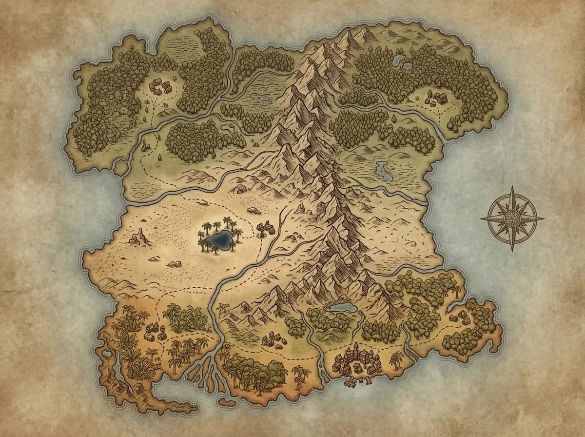
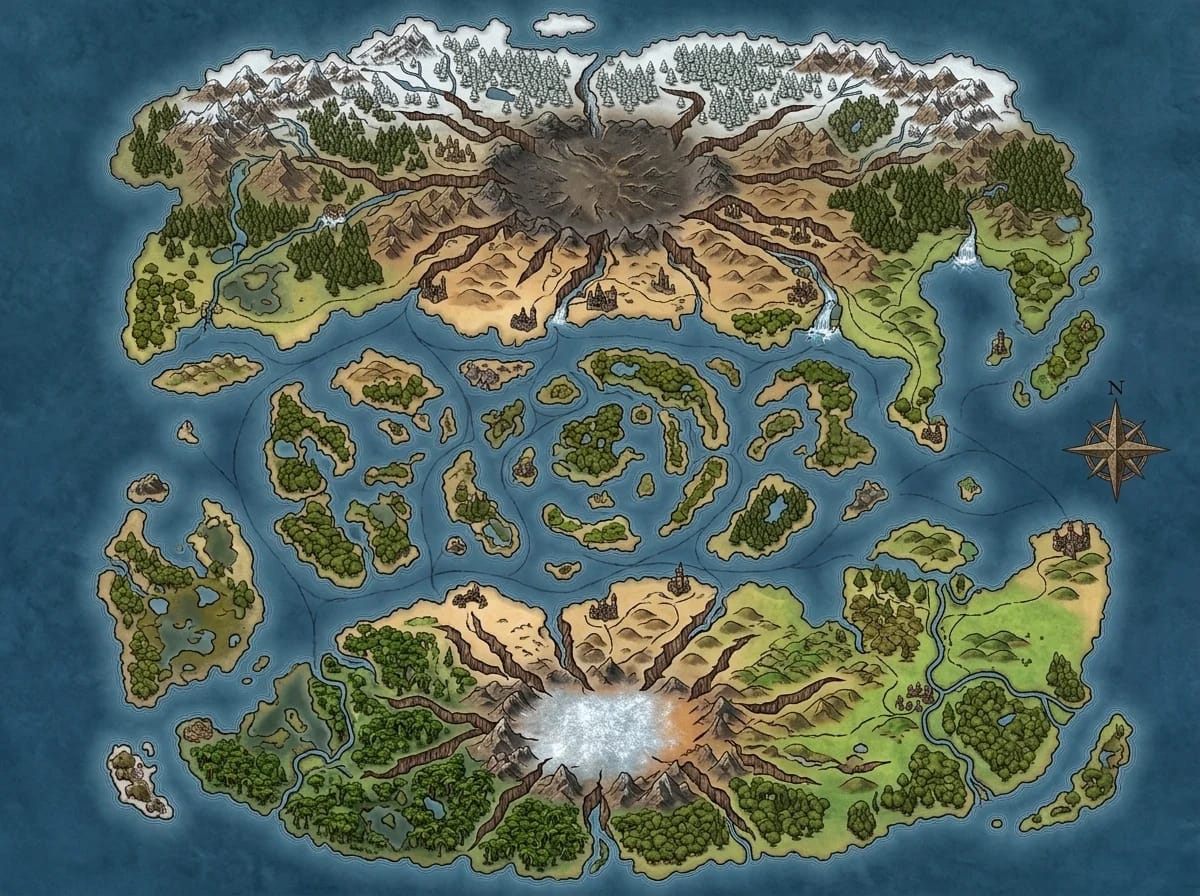
Pangaea-Style Supercontinent
A single massive landmass stretching across the known world — a central desert belt divides the northern temperate forests from the southern tropical coast, and a spine of mountains running east to west creates a natural barrier between civilizations that have never met. Inland seas break the monotony, and a volcanic chain on the western edge hints at tectonic forces still shaping the land. This continent map generator produces the kind of epic-scale geography that defines entire campaign settings: the mountain range isn't just terrain, it's the reason two empires have never gone to war.
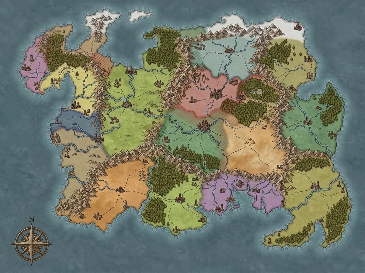
Multi-Kingdom Political Continent
A continent carved into a dozen nations — color-coded borders follow rivers and mountain ridges, trade routes connect capital cities with dotted lines, and contested regions are hatched in overlapping colors. A free city sits at the continent's crossroads, claimed by none and used by all. Diplomatic notes in the margins mark alliances and rivalries. The continent map maker turns political geography into storytelling fuel: players can see at a glance which kingdoms share borders, which control chokepoints, and which are one assassination away from open war.
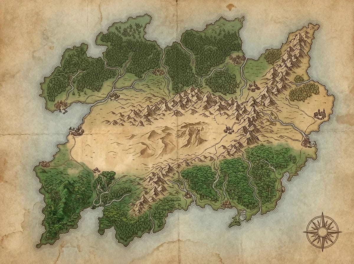
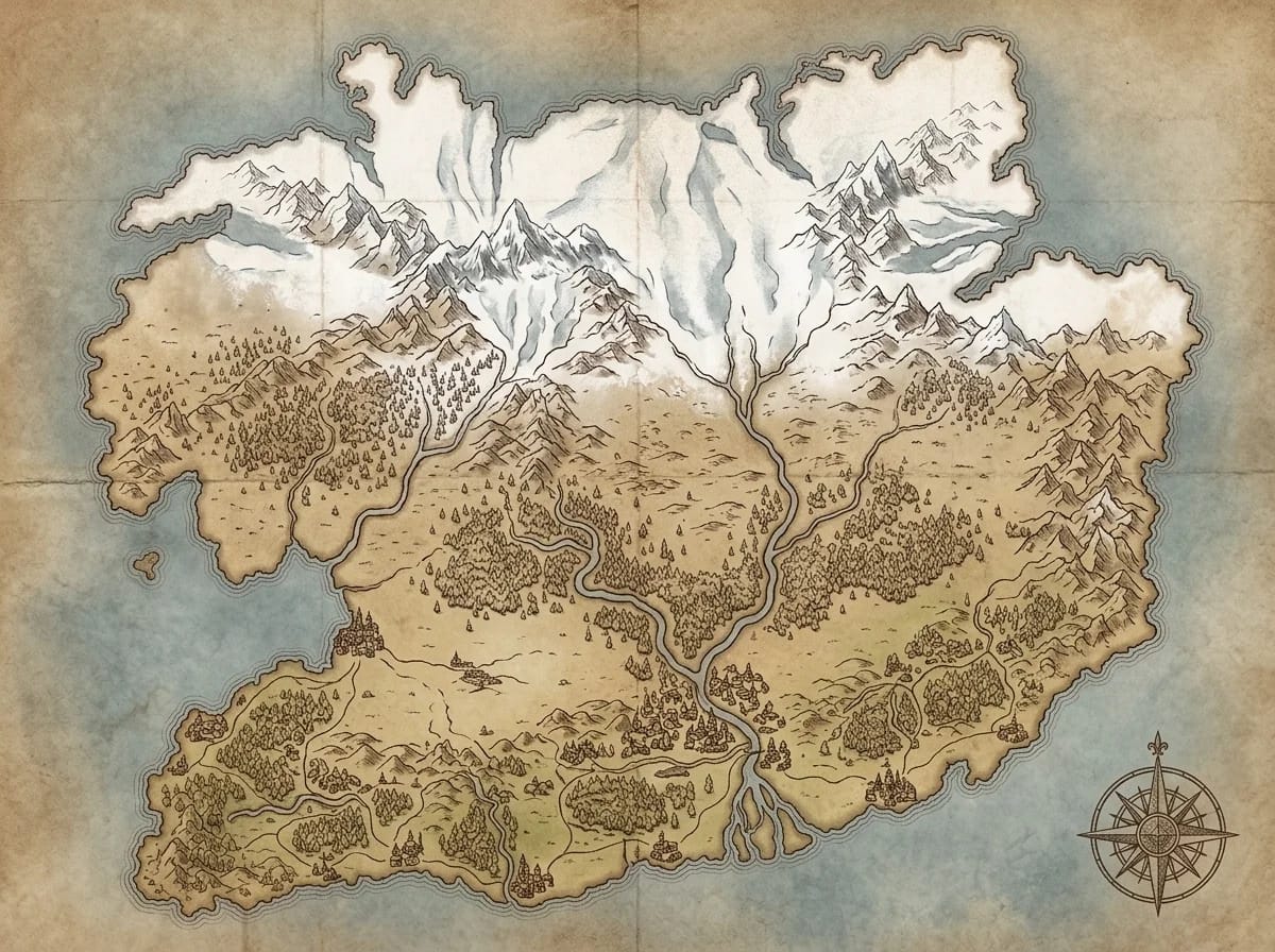
Coastal Continent with Detailed Shoreline
A continent defined by its coastline — deep fjords cut into the northern shore, a massive river delta fans out across the southeastern lowlands, and a chain of barrier islands protects the western harbors. Port cities cluster where rivers meet the sea, and lighthouses mark the treacherous rocky headlands. Every bay and peninsula has a name. This continent map creator pays attention to where land meets water, because that's where civilizations actually grow: the coastline determines trade, naval power, and which nations look inward versus outward.
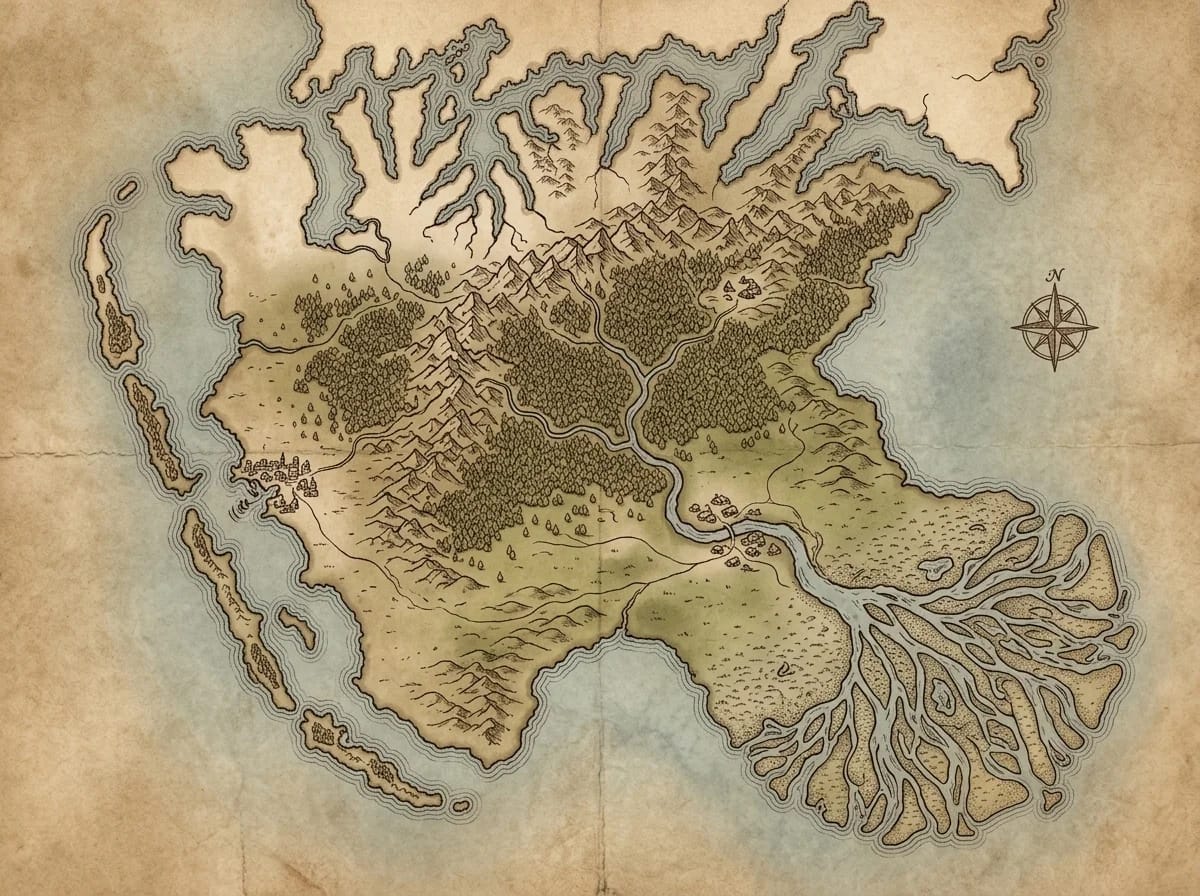
Shattered Continent
A continent that was once whole — the central region has fractured into a maze of islands separated by narrow straits, while the northern and southern landmasses remain intact but scarred with canyons that radiate from the point of impact. Ruined bridges span some gaps, and the submerged foundations of drowned cities are visible in shallow waters between fragments. A continent map generator that builds broken worlds gives DMs a built-in mystery: what shattered the continent, can it happen again, and what's buried in the ruins beneath the waves.
Ice-Age Continent
A continent gripped by glacial advance — ice sheets cover the northern third, pushing civilization southward into crowded coastal lowlands. A frozen land bridge connects to a neighboring continent, and megafauna migration routes cross the tundra between sheltered valleys. The southern coast remains temperate, and a walled city at the ice sheet's edge serves as humanity's last outpost against the creeping cold. This continent map maker creates settings where climate is the campaign's driving force: the ice advances one hex per decade, and every kingdom is making hard choices about retreat, resistance, or adaptation.
Describe a Landmass, Get Atlas-Quality Cartography
Draft Your Continent's Geography
Start with the big picture: "A continent shaped like a crescent, with a central mountain spine running north-south, temperate forests on the eastern coast, arid plains in the rain shadow to the west, and a volcanic island chain off the southern tip." The continent map generator reads tectonic, climatic, and geographic context and translates it into a coherent continental landmass.
Pick a Cartographic Tradition
Parchment World gives aged atlas-style continent maps on yellowed paper — the classic worldbuilding aesthetic. Fantasy World produces painted geographic maps with color-coded biomes and terrain. Fantasy Regional renders the continent as a 3D terrain model viewed from altitude.
Refine Borders and Terrain, Then Publish
Review your continent map and use the Refine tool to reshape a coastline, extend a mountain range, or add a political border. Export at 1K for a campaign overview, 2K for a continent map players can study, or 4K for a wall-sized atlas print.
Who Uses This Continent Map Creator?
Fantasy Worldbuilders
Build the foundational landmass of your fantasy world. This continent map generator produces the geographic canvas on which nations, cultures, and histories are built.
Campaign Setting Designers
Create continent maps for published or homebrew campaign settings. This continent map maker produces atlas-quality cartography that anchors an entire world's geography.
Novel & Fiction Authors
Visualize the continent where your story takes place. This continent map creator helps maintain geographic consistency across complex narratives with multiple nations and travel routes.
Virtual Tabletop GMs
Generate continent maps for Roll20, Foundry VTT, and Owlbear Rodeo. This continent map generator exports at any resolution for campaign overworld displays.
Geography & Education
Create fictional continents for educational projects, writing exercises, and worldbuilding workshops. This continent map maker produces realistic-looking landmasses based on real geographic principles.
Continent Map Generator FAQ
Yes! Create your first continent map free when you sign up — no credit card needed. This continent map maker generates detailed continental cartography at no cost. For unlimited continent map generation and 4K export, check our paid plans.
Continent Map Generator Resources
Continental cartography guides, landmass design tips, and world geography tutorials for worldbuilders
Fantasy Continent Design: Rivers, Mountains, and Why Geography Matters
I used rain shadows, river confluences, and real geology to build a fantasy continent that felt alive. Here's how geographic logic transforms your world maps.
Read moreBlank Continent Maps: Why Starting Empty Beats Starting Full
A blank continent map isn't lazy — it's strategic. Why 60% empty space creates better campaigns, and the progressive disclosure framework I use every session.
Read moreContinent Names That Don't Sound Like Random Syllables
5 naming techniques that turn random syllables into continent names your players remember — root blending, geographic anchors, historical echoes, and more.
Read moreExplore More Free Map Generators
AI World Map Generator
Create complete world maps with multiple continents, oceans, and global geography.
Try NowAI Kingdom Map Generator
Generate fantasy kingdom maps with territories, borders, and political geography.
Try NowAI Island Map Generator
Create fantasy island maps with coastlines, terrain, and points of interest.
Try NowAI Hex Map Generator
Build hexagonal grid overworld maps for sandbox RPG exploration campaigns.
Try NowAI Fantasy Map Generator
Generate stunning fantasy maps with full style control for any creative project.
Try Now