
Fantasy Continent Design: Rivers, Mountains, and Why Geography Matters
I used rain shadows, river confluences, and real geology to build a fantasy continent that felt alive. Here's how geographic logic transforms your world maps.
Twenty-eight sessions into The Shattered Coast, I pulled up a Wikipedia article on rain shadow deserts at 1:00 AM on a Wednesday. I'd placed a dense pine forest on the eastern side of my tallest mountain range — the Stormbreak Mountains — because forests look good next to mountains. That forest should have been a desert. No fantasy continent name generator or continent generator can fix geography that doesn't make physical sense.
Rain shadows form when moisture-laden air rises over mountains, drops its water on the windward side, and leaves the leeward side bone-dry. The Gobi Desert exists because of the Himalayas. The Great Basin in Nevada exists because of the Sierra Nevada. And my pine forest existed because I didn't know any of that when I typed my first prompt into a continent map generator.
That 1:00 AM rabbit hole changed how I build every fantasy continent map. Not because players will quiz you on atmospheric circulation — they won't. But because geography that follows real-world logic generates story without you having to force it. And story that emerges from the map feels inevitable instead of invented.
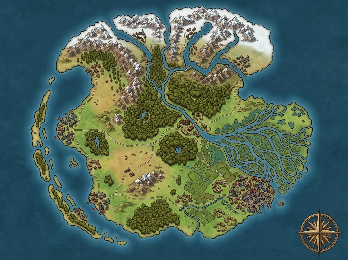
The Shattered Coast: A Full Geography Audit
I've run The Shattered Coast for 14 months — 47 sessions with my Wednesday group. The world started as a 23-word prompt: an inland sea splitting two landmasses, a volcanic island chain to the south, frozen tundra up north, three coastal cities. I generated the map in 90 seconds and didn't think about geology for the first 6 months.
Then I started reading. Plate tectonics articles. River morphology studies. A Brandon Sanderson BYU lecture on worldbuilding where he argues that the best fantasy settings have an "iceberg" of geological logic beneath the surface. I went back to my map and found 3 things the geography was telling me that I'd missed — and 2 things I'd gotten embarrassingly wrong.
Rivers Don't Split — They Merge
The single most common geography mistake in fantasy continent maps: rivers that fork as they flow downstream. In reality, rivers almost never split. They merge. Small tributaries join larger channels, flowing from high ground to low ground, always taking the path of least resistance to the sea.
On the Shattered Coast, the eastern river — the disputed border between two duchies — flows south from the northern highlands into the inland sea. When I first sketched the campaign notes, I'd drawn two branches splitting off near the border. One east toward the coast, one continuing south.
That's not how water works.
Rivers join at confluences. And the confluence point — where two rivers meet — is almost always where a city sits. London on the Thames. Khartoum where the Blue and White Nile meet. Pittsburgh at the Three Rivers. Once I understood this, I repositioned my border town to sit at the confluence where a highland tributary joins the eastern river. Suddenly the disputed border had a geographic reason: both duchies wanted to control the confluence because it controlled trade downriver.
I didn't invent that conflict. The river logic created it.
If you're using a continent generator and you see a river splitting into two branches heading to different coasts — that's a canal, not a river. Either someone built it (which is a story) or the map needs adjusting.
Rain Shadows Tell You Where Civilizations Grow
Back to my 1:00 AM revelation. Rain shadows aren't just a desert-creation mechanism — they're a civilization placement tool.
Here's the principle: prevailing winds carry moisture from the ocean. When that air hits a mountain range, it rises, cools, and dumps rain on the windward side. The leeward side gets almost nothing. This means one side of your mountain range is lush, fertile, and able to support large populations. The other side is arid, sparse, and inhabited by people adapted to scarcity.
On the Shattered Coast, the prevailing winds come from the west — off the great ocean. The Stormbreak Mountains run roughly north-south along the western portion of the main landmass. That means the western coastal strip gets heavy rainfall, which explains Ashenvale's dense forests and agricultural wealth. The interior east of the range should be drier — which accidentally aligned with Kethranor's austere, resource-scarce theocracy that forbids arcane magic.
I didn't plan that thematic alignment. The geography implied it.
When I realized this after 28 sessions, I leaned into it hard. Kethranor's people became culturally defined by scarcity — their religious prohibition on arcane magic suddenly made sense as a society that couldn't afford waste. The rain shadow didn't just describe weather. It described an entire civilization's psychology.
Sanderson's lectures hammer this point: if you change one geographic variable, trace the second-order consequences. A rain shadow doesn't just create a desert — it creates a culture shaped by that desert. A trade deficit. A military strategy built around controlling mountain passes. A mythology that explains why the gods cursed this land to be dry. If you're building a fantasy continent map from scratch — whether through a continent map generator or by hand — pick your mountain ranges first, then decide which direction the wind blows. The rain shadow tells you where the food grows, and where the food grows determines where 80% of your population lives.
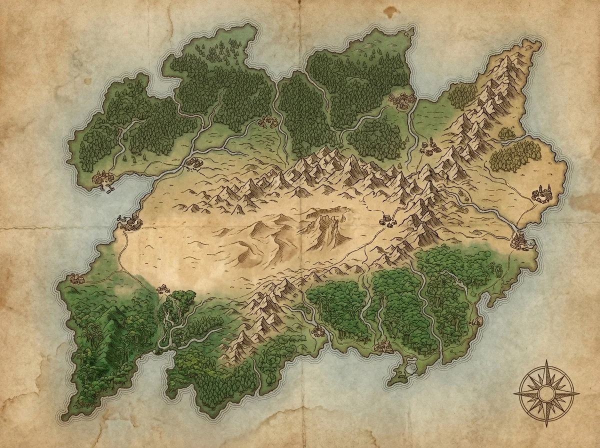 Notice how the major mountain chains follow what looks like a tectonic boundary — the continent generator produced geography that implies plate movement without anyone programming it.
Coastlines Are Tectonic Fingerprints
The Shattered Coast got its name from its coastline — jagged, broken, full of inlets and island fragments. I chose that aesthetic because it looked dramatic. But shattered coastlines have a geological cause, and understanding that cause made my volcanic island chain click into place.
Real coastlines shatter for two main reasons: tectonic activity (plates colliding, diverging, or sliding past each other) and glacial retreat (ice age glaciers carving fjords that later flood). Scandinavia's coast is glacially shattered. Indonesia's is tectonically shattered.
On my map, the volcanic island chain to the south is the smoking gun. Volcanic chains form along subduction zones — one plate sliding under another, pushing magma upward. The Pacific Ring of Fire. The Aleutian Islands. My dwarven mining colony's obsidian-rich archipelago.
Once I understood this, the southern geography told a unified story: the plate boundary that created the volcanic islands also shattered the main continent's coastline. The same forces that give the dwarves their obsidian explain why the coast fractures into a thousand inlets — inlets that became pirate havens and the Shard Isles' power base.
Three factions from one tectonic principle.
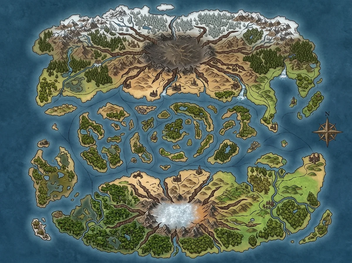 The fractured coastline isn't decorative — it's the surface expression of the same tectonic forces that built the volcanic chain. Geography that connects generates worlds that feel coherent.
How Geography Becomes Your Fantasy Continent Name Generator
Here's a pattern I stumbled into: once the geology makes sense, the names practically write themselves.
The arid plateau east of the Stormbreak Mountains? My players started calling it "the Dustreach" before I'd named it. The sheltered inlet where the pirate fleet anchors? "Stillwater Cove" — because the geography implies calm water behind a headland. The volcanic island where the dwarves mine obsidian? "Ashfire Island" — the landscape suggests the name.
I used to agonize over a fantasy continent name generator, scrolling through options trying to find something that "felt right." Now I realize that names feel right when they describe geography that makes sense. "The Shattered Coast" isn't a creative name — it's a literal description of a tectonically fractured coastline. It works because the geography it describes is internally consistent.
When you name continents, start with what the land does. A rain shadow desert, a river confluence, a volcanic ridge — the geographic feature is already the name. You're just translating it. The best fantasy continent name generator is a map that makes geological sense.
The Geology I Got Wrong
Geography didn't save me from some genuine mistakes.
The pine forest that should have been scrubland. My most embarrassing one — 28 sessions of describing "the eastern pinewoods" before I learned about rain shadows. I quietly shifted descriptions to "dry scrub forest with wind-bent trees" and no player noticed. But I noticed, and every session after that felt more honest. The lesson: you can retcon biome descriptions without retconning the map. Players remember events, not tree species.
I put a major port on a straight coastline. Real ports need harbors — natural bays, river mouths, or headlands that break wave action. My initial Ashenvale capital sat on a smooth stretch of coast with no geographic reason for ships to stop there. I eventually worked in a river mouth that the original AI-generated map actually showed — I'd just ignored it. The lesson: if you've placed a coastal city, check whether the coastline actually wants a city there.
My rivers flowed uphill. The eastern river's main tributary appeared to flow from low coastal marshland toward higher interior hills on my world map generator output. Water doesn't climb. I hadn't paid attention to implied elevation. Now I always check: does this river system make gravitational sense?
None of these broke the campaign. But fixing each one made subsequent sessions feel more grounded — like the world had weight, not wallpaper.
When Real Geography Gets in the Way
Not every fantasy continent needs to pass a geology exam.
Magical geography overrides physics. A floating mountain held up by ancient magic doesn't follow rain shadow logic. Magic should break rules — but you should know which rules it's breaking. A floating mountain is more impressive when the world around it obeys the rules it defies.
Speed of play trumps accuracy. If your players need to cross a mountain range this session and realistic travel would take 3, compress the distance. The map serves the game.
Mythic campaigns operate on dream logic. If the sun is a sleeping god's eye and rivers flow with liquid starlight, plate tectonics isn't your priority. This post assumes you want a world that feels plausible. Not every campaign does.
The Broader Principle
I think most worldbuilders design continents backward. They start with kingdoms, then jam mountains between them as borders. Real geography works the other way: the mountains come first, and the kingdoms form around them. The rivers come first, and the cities grow where the rivers meet. The coastline comes first, and the culture adapts to what the coast provides.
Geography is narrative infrastructure.
Roads, borders, cities, conflicts, trade routes, cultural identities — all sit on top of geography. When the geography follows internal logic, everything built on top inherits that logic. When it doesn't, everything feels slightly off, even if nobody can articulate why.
If you start your next blank continent map with three decisions — where are the mountains, which direction does the wind blow, and where does the water flow — the civilizations will practically place themselves. You won't need a fantasy continent name generator for the arid plateau because the landscape already named it. The disputed border will follow the river that was already there. The port city will sit where the bay already opens.
I've built 3 continents across my campaigns. The one I prepped in 47 minutes flat worked fine for 47 sessions. The one I rebuilt with rain shadows, river confluences, and tectonic reasoning works for the same sessions, but it explains itself. The ranger in my Wednesday group started predicting where rivers would lead before I described them. Marcus's fighter chose routes based on terrain logic. Players stopped asking "where do we go?" and started asking "what's on the other side of that mountain?"
That's the difference between a map and a world.
Your next continent needs three questions answered: where are the mountains, which way does the wind blow, and where does the water go. Answer those, and the rest — the borders, the cultures, the names, the conflicts — will grow from the terrain the way cities grow from rivers.
Geography isn't the decoration on your fantasy world. It's the skeleton.
Related Reading
- Map a Continent in Under an Hour — The speed-first workflow for continent mapping when you need playable, not perfect.
- Blank Continent Map Design Strategy — Why leaving 30–40% of your continent unlabeled is a feature, not a bug.
- I Built a Fantasy World in 3 Hours — The full Shattered Coast creation story, from first prompt to session 1 hook.
- AI Continent Map Generator — Generate continent-scale maps with geographic features in under 90 seconds.

Written by
Toby
Indie Developer & Creator of FantasyGen
Toby is an independent developer focused on building AI-powered creative tools. He created FantasyGen to help game masters and worldbuilders generate fantasy maps instantly — no artistic skills required.
Continue the Campaign
Blank Continent Maps: Why Starting Empty Beats Starting Full
A blank continent map isn't lazy — it's strategic. Why 60% empty space creates better campaigns, and the progressive disclosure framework I use every session.
Continent Names That Don't Sound Like Random Syllables
5 naming techniques that turn random syllables into continent names your players remember — root blending, geographic anchors, historical echoes, and more.
How I Map a Continent in Under an Hour (and Why Detail Kills Scale)
I mapped 3 continents for The Shattered Coast in under an hour. Here's the continent map workflow that prioritizes playable scale over obsessive detail.