

Building a Kingdom Map From One City Outward
How I mapped 7 kingdoms from a single port city in my D&D campaign. A DM case study on building a kingdom map outward through trade routes and conflict.
Session 26 of The Shattered Coast, my players sailed into Driftholm — a port city I'd prepped as a one-session rest stop. Four districts: The Docks, Saltmere Market, Old Town, Cliff Quarter. A smuggling problem I figured would take 2 hours to resolve. That was 21 sessions ago. Driftholm is still the gravitational center of this campaign, and the 7-kingdom DnD kingdom map I run today grew outward from that single harbor.
I didn't start with a kingdom. I started with one city and one question: what's on the other side of the water?
That question pulled me outward — from docks to trade routes, from trade routes to rival ports, from rival ports to the political fractures that turned a rest stop into the most layered fantasy kingdom map I've run across 340+ sessions of D&D. Here's how it happened, what it taught me about building DnD kingdom maps, and the one thing I'd do differently.
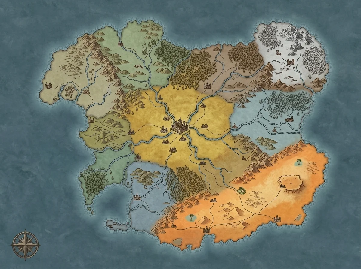
The City Came First. The Kingdom Grew From Its Needs.
Driftholm sits on the southern coast of Ashenvale — a declining empire tangled in a succession crisis, 3 factions fighting for a throne that's losing relevance by the session. I didn't know any of that when the party arrived. I knew Driftholm had docks, a market that smelled like brine and cardamom, and a smuggling ring moving obsidian-laced weapons through the harbor.
That smuggling ring is what forced me to build outward.
The weapons had to come from somewhere. I generated a quick city map of Driftholm's harbor district to figure out the logistics — where ships would dock, which warehouses had easy access to the Old Town alleys, how the Cliff Quarter literally overlooked the docks from above. The geography of the city told me the smugglers needed a supply chain that couldn't be watched from the cliffs.
So I looked south. The Shard Isles — a pirate confederacy with no central government and a dwarven mining cartel that processes obsidian — became the answer. Not because I'd planned it. Because Driftholm's geography demanded it.
Brandon Sanderson describes this in his BYU worldbuilding lectures as the "iceberg principle" applied to setting design: you don't build the iceberg and then put it in the ocean. You put a point of ice in the ocean and let it imply the mass beneath. One smuggling ring implied an entire island confederacy. One trade route implied a geopolitical rivalry that's been burning for 3 real-world months at my table.
Your kingdom map doesn't start with borders. It starts with one city's unanswered questions.
Trade Routes Drew the Map Faster Than Any Plan
Once I had Driftholm and the Shard Isles, the trade route between them became a line on the map. That single line did more worldbuilding than anything I'd outlined in advance.
Follow the logic. Obsidian flows north from the Shard Isles to Driftholm. But obsidian is the basis of the Shattered Coast's currency — those shards are money. Whoever controls the shipping lane controls the economy. Which means the route needs naval protection. Which means someone along the coast commands a fleet.
That someone became Kethranor — a theocracy to the east that forbids arcane magic but runs the most disciplined navy on the continent. Kethranor didn't exist until I needed a power to contest the Shard Isles' shipping lanes. The kingdom was born from a trade route, not from a lore document.
Within 3 sessions of drawing that first line on my DnD kingdom map, I had:
- Driftholm — the port city where goods and secrets change hands
- The Shard Isles — the source of obsidian, pirate-governed, bound by no treaties
- Kethranor — the naval theocracy that wants to "civilize" the trade corridor
- Ashenvale — the declining empire that technically owns Driftholm but can't enforce its own laws
- The disputed waters — where all three powers' interests collide
Four named powers and a contested zone. All from one smuggling ring in one port city.
A thread on r/worldbuilding calls this "demand-driven worldbuilding" — you build the next piece of the world only when the current piece demands it. I've used that phrase at my table since session 30 because it describes exactly what happened with the Shattered Coast.
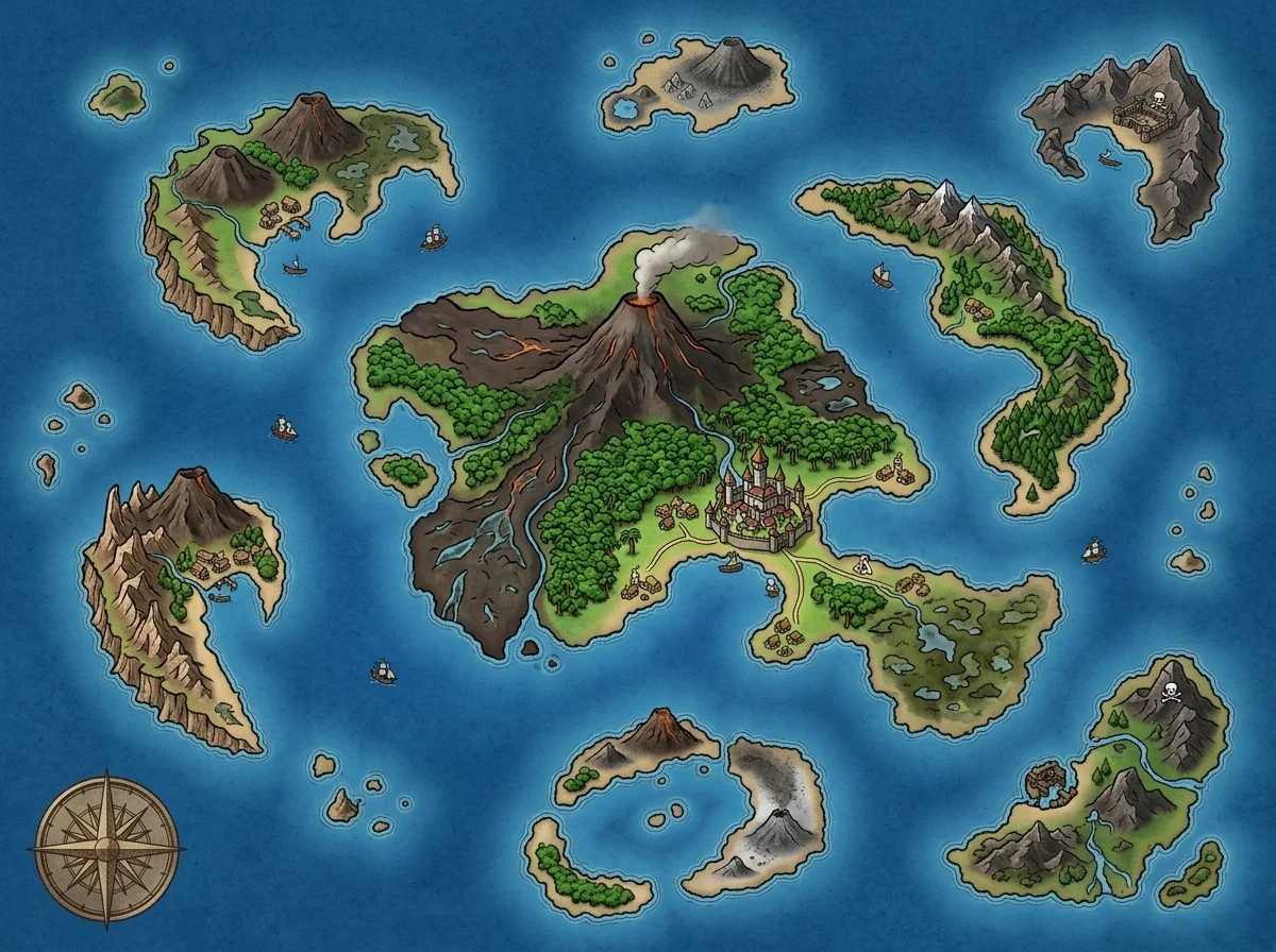 The Shard Isles in my head — scattered islands with no central authority, each one a potential faction. The unnamed isles at the edges became smuggler hideouts my players keep trying to find.
Rival Powers Emerged From Pressure, Not From Lore
Here's where most DnD kingdom maps go wrong — and where mine almost did too.
The temptation, once you have 4 powers on the map, is to sit down and write lore for each one. Government structure. Founding myths. Religion. Cultural practices. I know the temptation because I gave in to it for my first homebrew world, where I wrote 4 kingdoms the size of Connecticut and my players crossed the entire map in 5 sessions.
For the Shattered Coast, I resisted. Instead of writing lore, I wrote pressure.
Each kingdom got one sentence of internal tension:
- Ashenvale: succession crisis — the old emperor is dying, 3 factions want the throne
- Kethranor: the head librarian secretly controls the church by deciding which religious texts are "approved"
- Shard Isles: no central government, but the mining cartel is quietly buying loyalty from individual island captains
- Driftholm (as a city-state within Ashenvale): the smuggling ring is funding one of the succession factions
Four sentences. Those 4 sentences have generated more player-driven story than any worldbuilding document I've written across 8 years of DMing.
Pressure creates movement. Lore creates reference. When Marcus's fighter found that weapons cache in a residential tenement basement — linking back to the Driftholm smuggling ring — he didn't need to read a history of Ashenvale. He needed to know that someone powerful was arming a faction, and the map told him where the weapons were going.
Your fantasy kingdom map should be readable as a pressure diagram, not an encyclopedia. If you can look at the map and see where conflict is building — contested trade routes, declining empires next to expanding ones, a theocracy eyeing a pirate confederation — you've built a playable kingdom. If you need 3 pages of notes to explain why anything matters, the map isn't doing its job yet.
I've started using a kingdom map generator to lay down the terrain first — coastlines, mountains, rivers — and then placing cities only at pressure points. River confluences. Harbor mouths. Mountain passes. The geography creates the pressure, and the pressure creates the kingdoms.
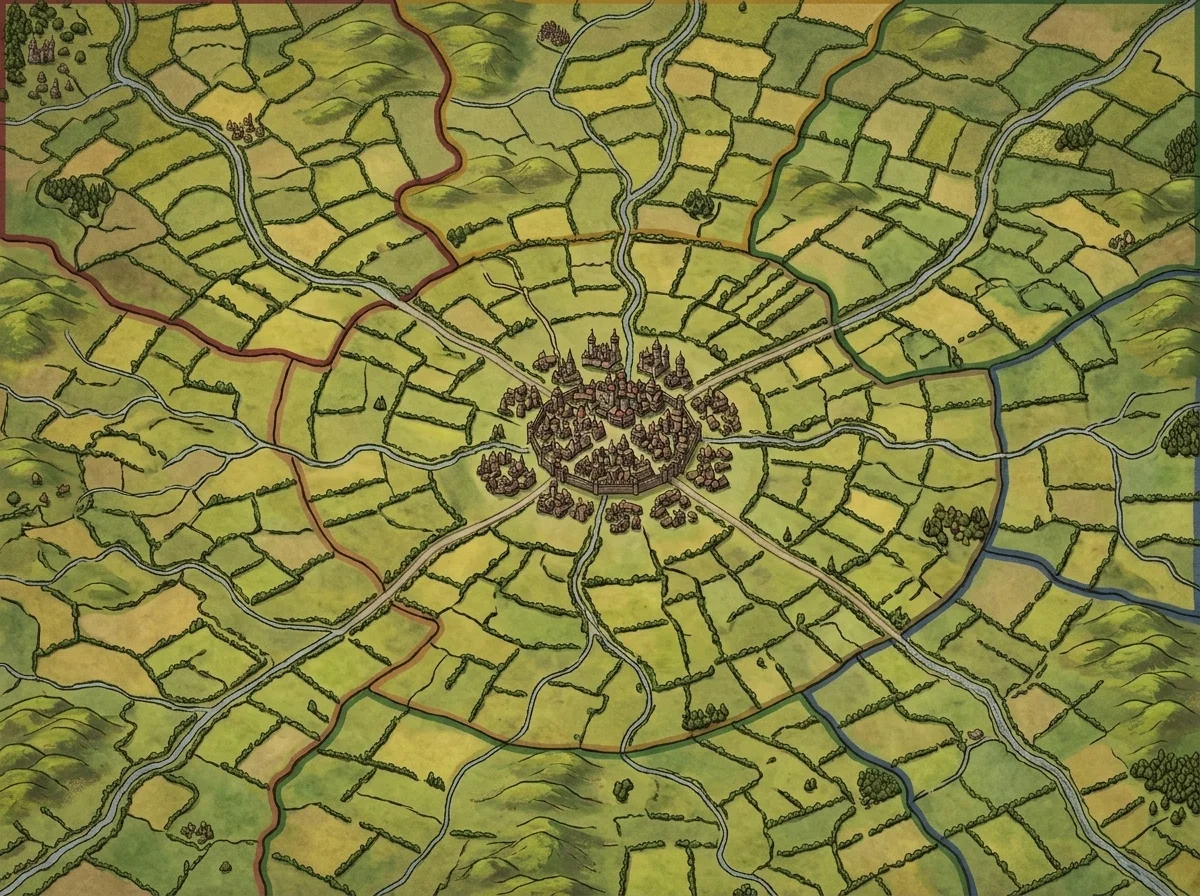 Feudal borders defined by terrain, not arbitrary lines. Every border here follows a ridge, a river, or a forest edge — and every one of them is a potential battlefield.
What I'd Map Differently Next Time
Three things I got wrong building the Shattered Coast outward from Driftholm:
-
I named kingdoms before players encountered them. Ashenvale and Kethranor were labeled on the map before anyone sailed there. The names carried no weight because players had no context for them. I wrote about the full naming workflow separately, but the short version: introduce the political identity first, the name second. "The theocracy across the strait" lands harder than "Kethranor" at session 1.
-
I drew clean borders too early. Borders should be messy — especially for a declining empire like Ashenvale. I drew neat lines at campaign start and then had to retroactively blur them when the succession crisis made territorial control ambiguous by session 35. Start with vague frontiers. Draw hard borders only when political control is settled, which in D&D means almost never.
-
I built all 7 kingdoms at once. The Shattered Coast has 7 kingdoms, 3 continents, and a 200-year timeline. My players have meaningfully interacted with 4 of those kingdoms across 47 sessions. The other 3 sit on the map, unused. I should have stopped at 4 and built the rest only when the campaign reached them. This is the most common kingdom map mistake I see other DMs make too — the urge to finish the atlas before session 1. I've collected more of these patterns in my guide to common kingdom map design mistakes.
Every one of these errors came from top-down instinct: the urge to complete the map before the campaign proves what it needs. The outward-from-one-city method works precisely because it resists that urge.
The Kingdom Maker's Rule: One City Is Enough
If the Shattered Coast taught me one thing about building DnD kingdom maps, it's this:
You don't need a kingdom to start a campaign. You need a city with one unresolved problem.
Driftholm's smuggling ring implied the Shard Isles. The Shard Isles' trade route implied Kethranor's navy. Kethranor's expansion implied Ashenvale's decline. Ashenvale's succession crisis implied the weapon shipments were funding a coup. Every kingdom on the map exists because the previous one demanded it.
That's not lazy design — that's organic design. And organic fantasy kingdom maps play better at the table because every piece of the world connects back to something players have already touched.
The workflow, if you want to try it:
- Build one city. Give it one economic function and one problem.
- Ask: who benefits from this city's problem? That's your second power on the map.
- Ask: who wants to stop them? That's your third.
- Draw the trade route connecting all three. Place it on a kingdom map generator so the terrain creates natural choke points and contested waters.
- Stop. Run 5 sessions. Expand outward only where your players push.
This works best for sandbox and open-world campaigns where player choice drives the direction of play. If you're running a published module — Curse of Strahd, Descent into Avernus — the kingdom structure is already defined, and top-down mapping serves you better. But for homebrews? One city. Every time.
Driftholm was supposed to be a rest stop. Twenty-one sessions later, Jess's rogue has cultivated a network of informants in the Saltmere Market, Marcus's fighter is sitting on evidence that could topple a succession faction, and Dan's wizard has been quietly investigating whether the Shard Isles' obsidian carries arcane properties that Kethranor doesn't want anyone to discover.
All of it started with one port city and a question about where the weapons came from.
Start there. One city. One problem. Build outward.
The kingdom will find you.
Related Reading
- Fantasy Kingdom Map: How to Make One Players Explore — Why blank space and political tension matter more than detail on your kingdom map
- Kingdom Names That Sound Like Real Places — The 4-step naming workflow that keeps Ashenvale alive and Thal'mazuur forgotten
- Kingdom Map Generator — Generate terrain and coastlines, then build your politics on top
- How One D&D City Map Took Over 12 Sessions — The Driftholm origin story in full detail

Written by
Toby
Indie Developer & Creator of FantasyGen
Toby is an independent developer focused on building AI-powered creative tools. He created FantasyGen to help game masters and worldbuilders generate fantasy maps instantly — no artistic skills required.
Continue the Campaign
Why Your Kingdom Map Has Too Many Castles and Not Enough Farms
Most kingdom maps are cluttered with castles and void of farmland. Learn the 3 economic design mistakes that make your fantasy kingdom feel like a board game.
Kingdom Names That Sound Like Real Places (Not Fantasy Noise)
A 4-step workflow for crafting fantasy kingdom names with a kingdom name generator. Build names players pronounce, spell, and remember after a single session.
Fantasy Kingdom Map: How to Make One That Players Actually Explore
Build a fantasy kingdom map players want to explore. Learn why most kingdom maps fail at the table and the 3 design shifts that turn decoration into adventure.