
Island Map Design: Coastlines, Secrets, and Why Shape Matters
A 5-step island generator workflow: shape the silhouette, carve coastline features, place harbors, and hide secrets. Design your island map from the outside in.
Look at a map of Crete. The southern coastline is sheer cliff face for almost 160 kilometers — no harbors, no towns, nothing but limestone dropping into deep water. The northern coast is the opposite: gentle bays, natural harbors, and every major city the Minoans ever built. One island. Two completely different civilizations. Determined entirely by coastline shape.
I've designed roughly a dozen islands over the past 3 years — the Shard Isles chain in my Shattered Coast campaign, a pirate one-shot for my Friday group, various standalone adventures. I've used every island generator tool I could find. And the islands that worked — the ones my players actually explored instead of just visiting — shared one trait.
I designed them from the outside in.
Most island map design tutorials skip this entirely. They start with the volcano. The dungeon. The treasure. But the coastline isn't the frame around your island content — it's the foundation everything else rests on. Here's my 5-step workflow for making a fantasy island map that feels like a place, not a circle with content inside it.
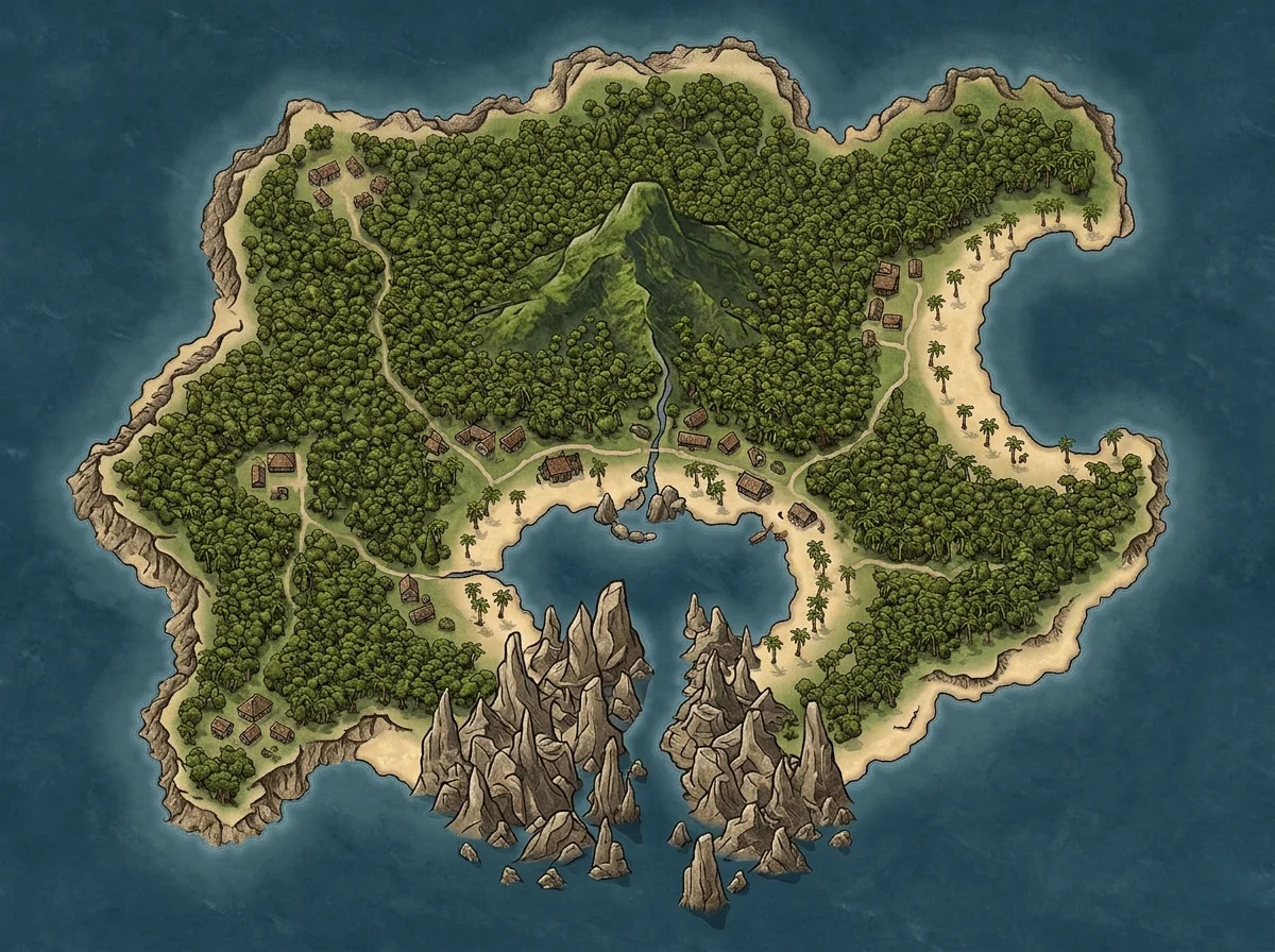
Why Coastline Comes First (Not the Volcano)
Here's what I see on r/worldbuilding every week: a DM posts an island map with a volcano in the center, a dungeon underneath, and a port town conveniently placed at the bottom of the map. The coastline? A vaguely circular blob drawn as an afterthought.
That's backwards.
The coastline determines where people live, how they trade, what they fear, and where they hide things. Every other decision — settlements, dungeons, ecology — is downstream of shape. Geography creates narrative without the DM having to force it.
Ursula K. Le Guin understood this intuitively in A Wizard of Earthsea. The Archipelago's islands each feel distinct because their interiors follow their coasts. Roke is sheltered and forested. Gont is mountainous and cliff-bounded. She never explains the geography — she lets the coastline imply the culture.
Your fantasy island map should work the same way.
The 5-Step Island Generator Workflow
Step 1: Start with the Silhouette (3 Minutes)
Before you add a single mountain or forest, generate just the outline. No terrain, no labels. Pure shape.
The silhouette tells you almost everything:
- Elongated — one long coast means a dominant trade route. Think New Zealand or Java.
- Compact / round — central power radiating outward. Contained. Defensible.
- Crescent / concave — natural harbor in the concavity. Trade hub or pirate haven.
- Fragmented — archipelago energy: factions, piracy, isolation. Think the Greek islands.
- Irregular with deep inlets — hidden harbors, fjord culture, naval defensibility.
When I built the Shard Isles for The Shattered Coast, I generated 4 silhouettes with the island map generator before picking one. The winner wasn't the prettiest — it was the most narratively loaded. A crescent-shaped main island with a natural harbor in the concavity. That harbor became the pirate confederacy's capital without me planning it.
Generate 3–4 silhouettes. Don't evaluate detail. Squint at shape. Pick the one that tells you the most story with zero labels.
Step 2: Carve Coastline Features (5 Minutes)
Once you have the silhouette, add the specific coastal geography that turns a shape into a place:
| Feature | What it implies | Adventure hook |
|---|---|---|
| Natural harbor | Trade hub, population center | Whoever controls the harbor controls the island |
| Sea cliffs | Defensive, isolating, ancient | Things above the cliffs were never meant to be reached |
| Coves | Hidden landings, smuggling | What's being brought ashore that the harbor masters don't see? |
| Beaches | Easy landing, invasion risk | Where raiders arrive — and where watchtowers belong |
| Tidal flats | Seasonal access, treacherous approach | The path to the old temple only exists at low tide |
| Mangrove swamp | Impenetrable coast, disease | Why nobody has mapped the southern shore |
This is where a good island map maker becomes genuinely useful. AI island generator tools produce coastline variation that hand-drawing rarely achieves — the kind of fractal irregularity that makes a fantasy island map feel geological rather than sketched.
I ran a pirate one-shot for my Friday group on an island I designed in about 12 minutes. The coastline had exactly 3 features: one deep harbor on the west (the pirate town), one shallow cove on the northeast (the secret landing), and sheer cliffs everywhere else. Three coastline decisions generated the entire session's geography — and 4 hours of gameplay.
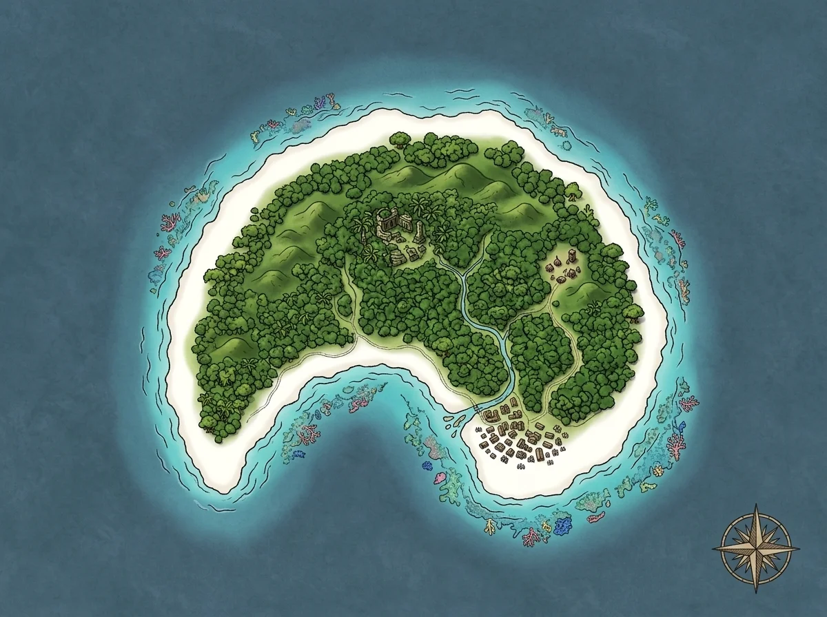 A tropical island where the reef line determines safe approach — ships navigate between coral formations to reach the inner lagoon.
Step 3: Interior Follows Coast Logic (5 Minutes)
Here's where most island design goes wrong: DMs place interior features first and wrap a coastline around them. Flip it. Let the coast dictate the interior.
The logic is straightforward:
- Windward coasts (facing prevailing weather) get rainfall → dense forest, rivers, farmland.
- Leeward coasts (sheltered) stay dry → scrubland, barren rock, desert.
- Cliffed coasts imply elevation → the interior rises toward those cliffs.
- Harbor coasts imply lowland → river deltas, flood plains, arable land near the port.
For D&D purposes: if you've placed a harbor on the east coast and cliffs on the west, the interior should slope upward from east to west. Rivers flow east toward the harbor. Forests cluster on the windward slopes. The bare western highlands are where the ruins sit — hard to reach, rarely visited, exactly where you want the dungeon.
You don't need a geography degree. You need one question: which direction is the easy side, and which is the hard side? The easy coast gets people. The hard coast gets secrets.
Step 4: Place Settlements Where Ships Can Land (3 Minutes)
Forget "interesting location" logic. Place every settlement based on one question: can a ship anchor here?
Real island civilizations cluster around harbors. Interior settlements are rare and usually serve mining, agriculture, or religious isolation. Coastal towns serve trade, defense, and survival. Island biogeography follows this pattern everywhere from the Caribbean to the South Pacific — and your fantasy island map should too.
I used to scatter villages across island maps like I was decorating a cake — even distribution, good visual spacing, zero geographic logic. Marcus's fighter once asked why a fishing village sat 6 miles inland with no river access, and I didn't have an answer.
That won't happen again.
Now my rule is strict: harbor access first, everything else second. A port at the natural harbor. A fishing village in the secondary cove. A watchtower on the headland overlooking the approach channel. A monastery on the clifftop — reachable only by a switchback trail carved into the rock.
For an island with 1 major harbor and 2 minor coves, I place 3–4 settlements maximum. An island with no safe harbor might have only a single desperate fishing village clinging to a narrow beach. That scarcity IS the story.
Step 5: Hide Secrets in Unreachable Coastline (5 Minutes)
This is the step that turned my island maps from adequate into memorable.
Look at your coastline. Find the stretches that are unreachable by ship — the cliff faces, the reef-choked shallows, the mangrove tangles. Those are where your secrets go.
The logic: if a coastline is unreachable from the sea AND far from any settlement, it's the perfect place for things that don't want to be found. Dragon lairs. Smuggler stashes. Ancient temples. Shipwreck survivors who've been marooned for decades.
In The Shattered Coast, one of the Shard Isles has a 3-mile cliff face on its southern shore. I placed a sea cave halfway up — visible from the water, reachable only by climbing 150 feet of wet limestone. Inside: the pirate confederacy's emergency treasury. Jess's rogue spent an entire session planning how to reach it.
That encounter came directly from looking at the coastline and asking one question: what's hiding where nobody goes?
The ship map generator pairs well here. If the secret requires a sea approach, having a ship battle map ready for the approach sequence makes the discovery feel earned rather than handed out.
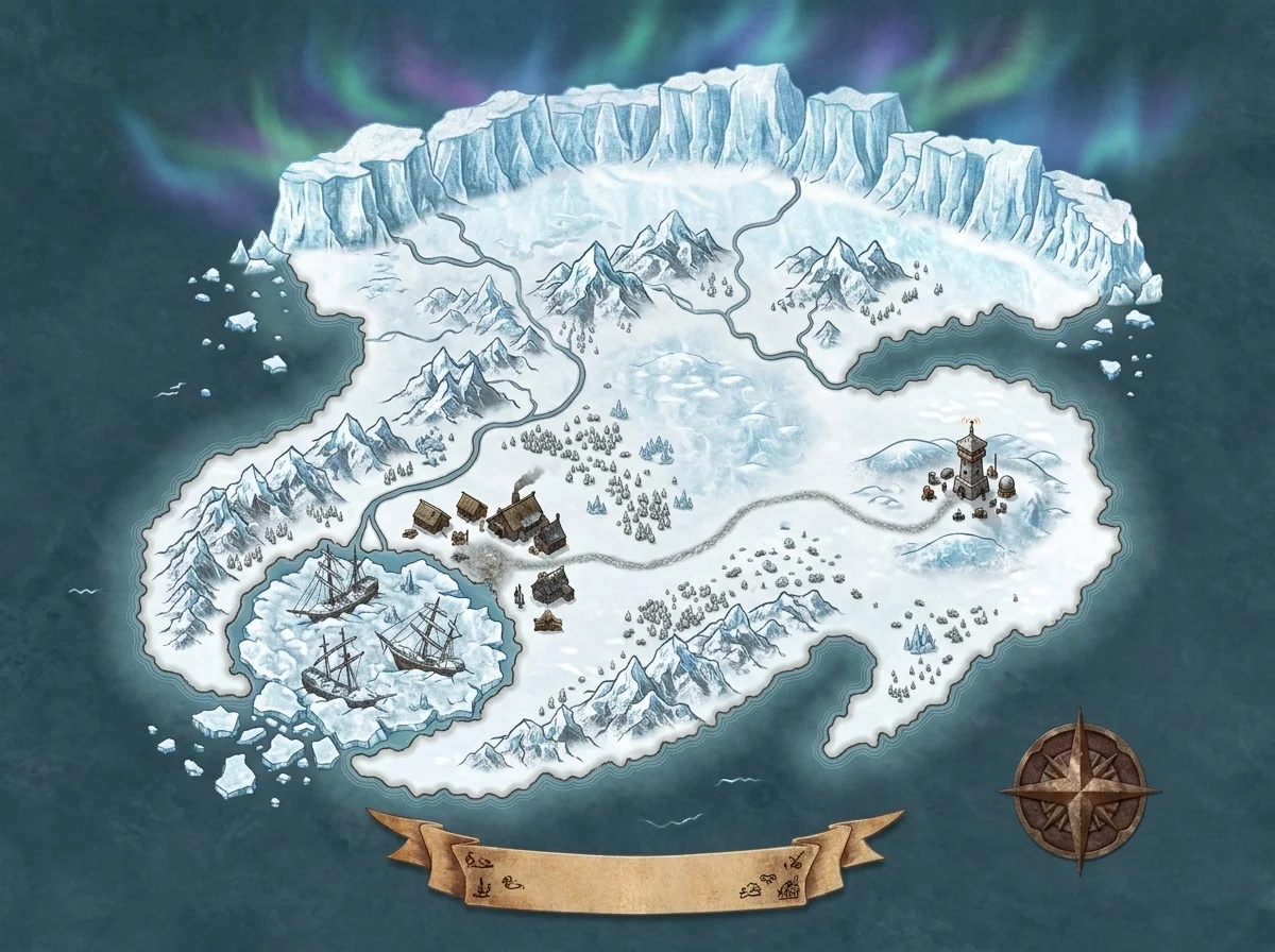 An arctic island — the ice shelf acts as a seasonal coastline. What's underneath the glacier is accessible only 2 months per year.
The Shape-to-Story Table
After building islands across campaigns, I started tracking which silhouettes generated the most gameplay:
| Silhouette | Best for | Worst for | Sessions of content |
|---|---|---|---|
| Crescent / concave | Pirate havens, trade ports | Wilderness survival | 3–5 |
| Elongated | Naval campaigns, coastal crawls | Dungeon-centric one-shots | 4–8 |
| Compact / round | Siege scenarios, contained horror | Open exploration | 1–3 |
| Fragmented archipelago | Political intrigue, faction play | Single-villain stories | 6–12 |
| Irregular with fjords | Mystery, hidden locations | Quick one-shots | 3–6 |
The fragmented archipelago consistently gives me the most sessions — but it demands the most prep. For a one-shot, I default to compact with one harbor and one hidden cove. In, out, done.
Three Exceptions (When Shape Doesn't Matter)
Coastline-first design doesn't always apply:
- Floating or magical islands — if the island flies, orbits, or phases between planes, physical geography is irrelevant. Design from the weird thing outward.
- Tiny islands (under 1 mile across) — at this scale, there's no meaningful coastline variation. It's a rock with a beach. Draw a circle, place your dungeon entrance, move on.
- Actively erupting volcanic islands — if the coastline is forming or collapsing in real time, shape is temporary. Focus on eruption dynamics and lava flow direction instead.
The Coastline Is the First Secret
Every island has a story baked into its geography before you write a single word of lore. The crescent harbor that funnels trade through a chokepoint. The cliff face that hides a cave network from every passing ship. The tidal flat that makes the southern temple accessible only 6 hours per day.
Your coastline isn't decoration.
It's the first puzzle your players encounter — they just don't realize they're solving it.
If you want to explore how island shapes feed broader narrative design, I wrote about turning island geography into storytelling hooks. And for the naming layer that sits on top of the map, the fantasy island names guide covers how coastal geography should influence what you call a place.
Pull up the island map generator. Generate 4 silhouettes. Pick the one that already tells you a story before you've placed a single label — then carve the coastline, follow the logic inward, and hide something worth finding where no ship can land.
The shape already knows where the adventure is.
You just have to listen to it.
Related Reading
- Fantasy Island Map: Storytelling Through Geography — How island geography creates narrative without lore work.
- Fantasy Island Names Guide — Naming islands based on their shape, culture, and coastal features.
- How I Map a Continent in Under an Hour — The same coastline-first logic applied at continental scale.
- Ship Map Generator — For sea approach, boarding, and coastal combat maps.
- Island Map Generator — Generate island silhouettes and coastlines in under 60 seconds.

Written by
Toby
Indie Developer & Creator of FantasyGen
Toby is an independent developer focused on building AI-powered creative tools. He created FantasyGen to help game masters and worldbuilders generate fantasy maps instantly — no artistic skills required.
Continue the Campaign
Fantasy Island Names That Sound Like Real Places (Not Random Vowels)
Learn 5 techniques for creating fantasy island names that sound like real places — geography anchors, colonial layers, and examples from actual D&D campaigns.
Fantasy Island Map: How to Build an Island That Tells a Story
I designed the Shard Isles — 5 volcanic islands where each coastline tells a different story. How one fantasy island map became a pirate campaign's foundation.
Fantasy Desert Map Design: Oases, Ruins, and the Paths Between
Learn how to design a fantasy desert map with oases as hubs, ancient ruins as dungeons, and caravan routes as encounter paths. A DM's campaign case study.